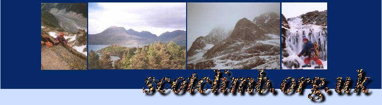
Coire Lagan
Isle of Skye
The round of Coire Lagan is one of the most fabulous days out on Skye. If you don't have time to do the whole ridge or if you don't really want to bivvy then this is a fantastic alternative. It is a true mountaineering expedition - hillwalkers beware.
The day I did this route started with fantastic weather - clear blue skies and blazing sunshine. Once we got to the top of the Great Stone Chute it was misty and cloudy and atop Sgurr Thearlaich is began to snow - good photos are therefor thin on the ground but I'll add them in as soon as I get some.
You will need:
- 50m of rope for the two abseil descents that are necessary on this route
- Harness, descender (fig8), 2/3 slings, 2/3 krabs & screwgates. Protection is optional.
- Ability to solo VDiff comfortably or a nice climber to escort you.
- A head for heights
- Camera/bino's, insect repellant and all the usual stuff.
Additionally you should note that there are magnetite deposits (as well as gold & platinum) so your compass isn't going to be as reliable as normal. Try to get a really good map and study it long in advance of leaving. If you feel like you know the terrain before you start you've a better chance when it gets really cloudy/foggy/snowy...
Maps
- Outdoor Leisure 8 (yellow), The Cuillin & Torridon Hills 1:25000
ISBN 0-319-26008-9) - Good choice. - OS Landranger 32 (pink), South Skye 1:50000 - Not very good for navigating.
- SMT, "The Black Cuillin" (Double Sided) - 1:12500
This is a hand drawn map showing escape points and a topo map which is also very useful. ISBN 0-907-52135-5
It may be useful to plan/familiarise yourself with your route by using both the OS 1:25000 map and the SMT maps as they show very different feature sets. The SMT maps are drawn explicitly with mountaineers in mind.
All grid references are from the OS Outdoor Leisure 8 map.
The Route!
There is some parking available outside the SMC Glen Brittle Momorial Hut at Ref 412217 but this might be impractical at weekends in mid-summer. Please don't park in any of the locals gardens. We will start the walk from the Glen Brittle Hut.
The Walk-in
The initial walk-in is very pleasant, heading along the marked path past Loch an Fir-Bhallich at 288m. From here you can get a nice view of the islands of Rhum and Soay. Continue up into Coire Lagan itself and make your way past the impressive rock faces and The Cioch on the right-hand side. The lochan at 444208 is easily reached. This is a good place to have a break and a snack.
Sgurr Alasdair & Sgurr Thearlaich
The normal route onto the mountain is to climb the "Great Stone Chute". This is an impressive sounding but rather nasty and very steep scree slope. There can be a lot of rockfall in this area after severe weather and the Skye MRT sometimes issue warnings - these will be on posters/notices at campsites/pubs on the island.
From the lochan you get your first glimpse of the Inaccessible Pinnacle.
Climb the chute in a basically straight line until you get to the top. You should find yourself at roughly 451207 - a little bealich between the peaks. Sgurr Alasdair (993m) is the highest peak and is situated immediately West. Leave your rucksac at the bealach and follow the crampon marks up the 5 minute scramble to the summit. And what a summit! On a good day the views of the ridg from any of the summits is incredible but the location of Sgurr Alasdair surely affords it the best view of all.
Descend back to the bealach and follow the faint path about 20m
downhill. If you look carefully you'll see a polished groove heading
straight up Sgurr Thearlaich - the standard of climbing is about MODERATE
but with the exposure it may seem a little harder. Most of the rock is
sound with only the occasional largish loose block. Climb in a
more-or-less straight line to the summit of Sgurr
Thearlaich.
NOTE: do not descend too far from the
bealach as it would be possible to miss Sgurr Thearliach and and up on
(or underneath in a squishy mess) Sgurr Dubh an Da Bhienn!
Continue down the sharp crest of the ridge taking your time to appreciate what is a truly remarkable situation. There are sheer drops on both sides (200m vertically back into Coire Lagan) which make the view even more dramatic.
Sgurr Thearlaich to Sgurr Mhich Coinnich
Steepening slabs lead downwards to Bealach Mhich Coinnich and, so the SMC guide tells us, it is possible to descent this way on foot - much care is required, though. The usual route (the way I went) now seems to be descending a steep path and moderate rocks on the western side of the ridge (facing into Coire Lagan) and stoping above a 20m vertical wall. There is an excellent belay point consisting of a solid pillar of rock some 3m high. You will note the abundance of abseil anchors at it's base. Please check these thouroughly before using them, or better still, remove anything that looks dodgy and replace it with a shiny new sling/rope. NB: Do not attach a sling to the top or the pillar - that's dangerous. Do not assume that any in-situ gear is safe. And remember - two anchors are better than one.
Abseil the 20m into the gully beneath the bealach and then ascend to the bealach itself. Collies Ledge (MOD/EASY) should be easily visible traversing around and up the fierce looking butress. Ascend via Collies Ledge and when something resembling a path appears you can either follow it, of climb the face (DIFF) directly to the summit. King's Chimney is apparently a fine line too (DIFF) - this is described as "an obvious big corner , avoiding an overhang."
The summit of Sgurr Mhich Coinnich has to be visited - do NOT be tempted just to continue following the path towards An Stac, the In Pin and ultimately the pub. From the summit you can sunbathe on the slabs with a nice view of the different parts of the ridge, Loch Coruisk or the sea. If it's clear you can watch the munro baggers being guided up the pinnacle (bino's).
Just be sure not to leave your fleece on the summit - this may cause uneccessary stress later. (Alex would like to thank the person who collected his fleece and left us a note on the car. Many thanks!)
An Stac
Descend from the summit of Sgurr Mhich Coinnich following the crest of the ridge until you're forced back towards Coire Lagan by a massive cliff. This is the distinctive notch in the ridge just before Sgurr Dearg - you should note this from the corrie on the walk-in. Keep descending by the vague path (with care) until you can pass beneath the notch - follow the path back up to the crest.
Even though it was snowing and foggy and cloudy we decided to follow the crest of An Stac to the base of the Innaccessible Pinnacle. The crest has a reasonably distinct route up moderate rocks - in poorer visibility an awareness of the huge cliff in the eastern side is needed. Some of the rocks on the scramble are loose and there are very few crampon marks however many rocks are polished and you can more-or-less make your own way to the up the scamble if neccessary.
Should you wish to avoid this scramble you can take some nasty scree instead... skirt close to the base of An Stac and ascend the scree slopes. Care required. At least you can't get lost on the crest of the ridge... (up or down or down very quickly).
The Innaccessible Pinnacle
Solo or lead the crest - it's the most fun. If you are belaying then there are several places you can place gear, alternatively there are some nice sling placements (a thread or two and a couple of spikes) on the route. If you decide to belay, climb in two pitches - there's a natural turn in the direction you climb and a good place to belay at the same spot (about halfway).
At the summit you can follow the shelf and abseil from the fixed (plastic sheathed steel sling) abseil point.
Descent to the Hut
Descend a ridge in a south-westerly direction from Sgurr Dearg on rocky and scree laden paths being careful not do descend into Coire na Banachdich or later onto Window Butress. The descent route should not present any difficulties - if it does you're probably going the wrong way.